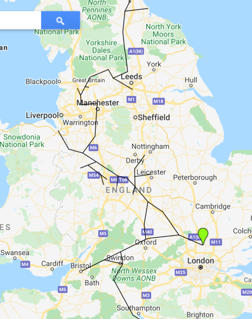
The above shows the map of the proposed project – Grand Contour Canal.
The plan was for a large ship canal to extend from Newcastle-upon-Tyne to Hampshire at 310 feet level to serve London, Bristol, Southampton, Birmingham, Manchester, Leeds, and Newcastle with no changes in level, and with interconnections to the rest of the inland waterways system. However, the project did not work out without practical solutions.
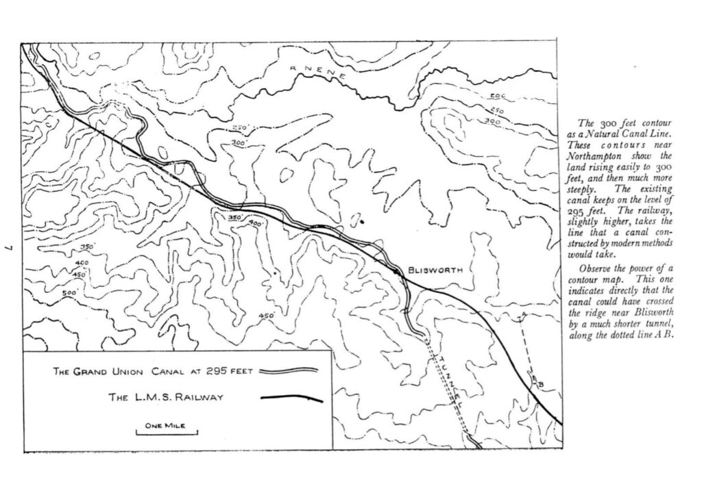
The natural canal line, prior to the Grand Contour Canal, created the bright prospects and concept of having a canal that runs the length of the nation and serves the populous areas without any change from one level.
This Grand Contour Canal would become the primary water distributor of the country if built. The canal was intended to flow in two directions. From London to Manchester, then northwards to Newcastle, then from London westwards to Bristol. The two routes depart from London through the lea navigation, which would be expanded and upgraded to Hertford in both directions. It would serve directly by waterway connections nearly all the great industrial areas of the country. Birmingham, Bradford, and many other towns would be supplied at a consistent 310-foot level, and by utilizing the many existing canal reaches at a single level, a vast number of towns would be served with only a single change in level, with vessel lifts from 310 ft. Many Vessel lifts were designed to apply in building the canal, it would level up the canal to 310 ft level, and continue its flow with no gap. In addition, as compared to canals with various levels, a one-level canal can be more effective, and the cost of operating traffic along it can be significantly lower due to the avoidance of time and water lost in locking, as well as the flexibility for trains to tow. Furthermore, a one-level canal, such as the Grand Contour canal, may be used as a water distributor since the artificial current could be generated without trouble and without obstructing navigation.
There is not necessary to restrict the size of the waterway of the Grand Contour canal because no water is required for locking along it. It is proposed provisionally that the waterway should be 30 meters or 100ft. The depth should be around 17 feet wide at the top, with a clear straightaway of 25 feet. The main terminal lifts would be 25 feet long inside, 35 feet wide, and 14 feet deep, with nine of them. All of the overbridges will have an 80-foot clear span over the canal. The lifts that would link to departing canals that would serve as branches to the new line would be much smaller, proportionate to the size of the vessel that would use the branch.
The most conservative aspect of the Grand Canal is that it would supplement the existing canal system, it would very connivance serve a long one-level waterway route between two places. Whatever the size of the vessel, once it enters the Grand Contour canal it can be picked up by the train and discharged to the widened open space of the canal. The Grand Contour Canal’s waterway will be able to accommodate coastal boats up to a certain size. There would be five terminal lifts in this project, with vessels descending from 310 feet to sea level in one lift, passing through the tide lock, and eventually finding the tidal water without any delays. In this way, the projected canal can effectively secure the economy of the transport in the nation.

Recreated Map using Google map